Wonderful trips to San Andrés and Providencia - INTI Tours
Living Caribbean Dreams
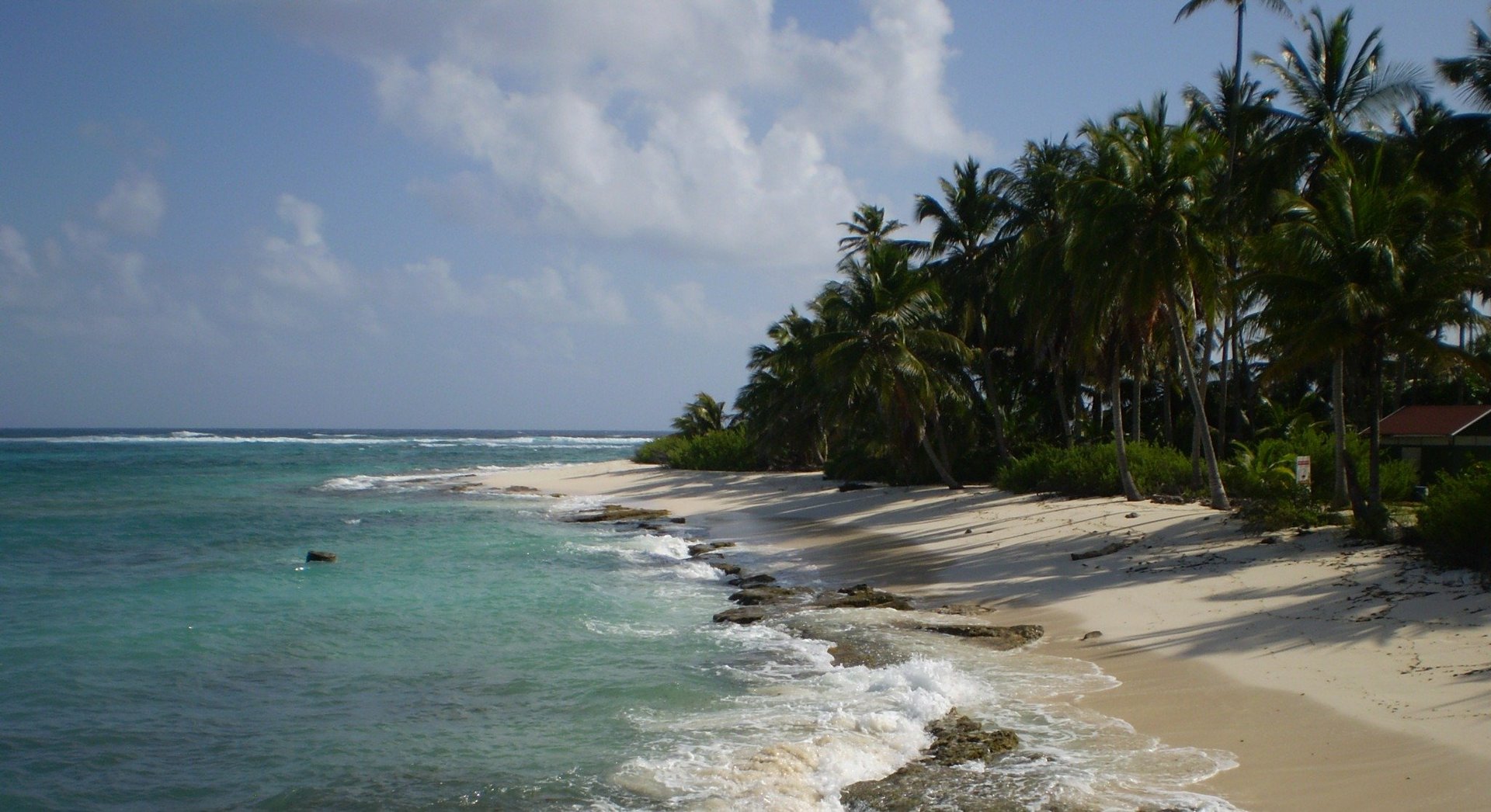
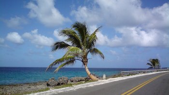
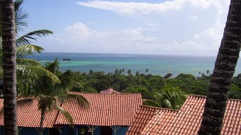
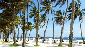
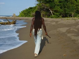
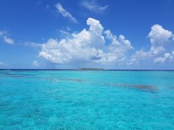
The three Caribbean islands of San Andrés, Providencia and Santa Catalina are located just 200 kilometers off the coast of Nicaragua, yet they belong to Colombia. When traveling to San Andrés and Providencia, you will experience the volcanic islands as a paradise surrounded by turquoise blue sea with magnificent coral reefs. San Andrés is more developed and frequented than Providencia, where it is even quieter and more pristine.
Bienvenidos a San Andrés y Providencia!
Country information Absolutely worth seeing Facts and figures Travel to San Andrés and Providencia Addresses
Our types of travel on San Andrés and Providencia
You may also like this…
Jamaica Northeast
Reggae, sea and jungle: Jamaica's northeast offers the majestic Blue Mountains, lush tropical nature with diverse vegetation, friendly open-minded people and a fine sandy beach on the magnificent Caribbean coast.
12 days Gruppenreise 2 up to 12 travellers
upon request
Caribbean Round Trip: Tobago, Trinidad, St. Lucia and Bequia
Caribbean round trip: Lonely snow-white sandy beaches, crystal clear sea, tropical rainforest, colorful coral reefs, picturesque villages, reggae music, exotic cocktails... Experience the most beautiful, largely undiscovered places of the Caribbean away from mass tourism!
15 days Bestseller 4 up to 12 travellers
upon request
Länderinformationen zu San Andrés und Providencia: „lebendig oder ruhig?“
Zum kolumbianischen Departement San Andrés y Providencia gehören die drei Inseln San Andrés, Providencia und Santa Catalina sowie acht Atoll-ähnliche Formationen in der Karibik. Der gesamte Archipel erstreckt sich über knapp 350.000 km². Obwohl die Inselgruppe etwa 800 km vom kolumbianischen Festland, dafür aber nur ca. 200 km von Nicaragua entfernt liegt, gehört sie zum kolumbianischen Staatsgebiet. Auf seiner vierten Fahrt 1502 entdeckte Christoph Kolumbus die Inselgruppe und die Bezeichnungen San Andrés und Santa Catalina wurden bereits 1527 auf der sogenannten Carta Universal verzeichnet.
Auf der Hauptinsel San Andrés erstreckt sich eine Bergkette von Nord nach Süd, die an ihrer höchsten Stelle nur 85 Meter über dem Meeresspiegel misst. Die Insel ist nur etwa 12 km lang und 3 km breit, knapp 75.000 Einwohner leben hier. Wälder aus Kokosnusspalmen bestimmen das Landschaftsbild. Die Uferregion besteht überwiegend aus zerklüftetem Vulkangestein und es gibt nur an wenigen Stellen Sandstrände. Die meisten der Inselbesucher sind Kolumbianer, die wegen der günstigen Einkaufsmöglichkeiten in der Freihandelszone anreisen.
Providencia kommt aus dem Spanischen und heißt soviel wie Vorsehung. Die zweitgrößte Insel des Archipels liegt etwa 90 km nördlich der Insel San Andrés, ist nur 17 qkm groß und zählt gut 5.000 Einwohner. Wie auch San Andrés ist die Insel vulkanischen Ursprungs und sie wird von Nord nach Süd von einer Bergkette durchzogen. Mit 360 M.ü.M ist der sogenannte El Pico die höchste Erhebung der Insel. Providencias Einwohner leben zum Großteil im oder in der näheren Umgebung des Hauptortes Santa Isabel.
Nur 122 Meter vor der Nordwestküste Providencias entfernt, liegt Santa Catalina, das nur gut 200 Einwohner zählt. Beide Inseln sind mit einer Ponton-Holzbrücke miteinander verbunden. Über sie gelangen sowohl Einwohner wie Touristen von Insel zu Insel.
Absolut sehenswert:
- Generell für alle, die Trubel und Beachleben lieben, ist San Andrés eine gute Wahl. Die Playa de Spratt Bight ist der Stadtstrand von San Andrés. Wer’s lebendig mag mit Bars, Restaurants und Geschäften, fühlt sich hier sehr wohl. Sehenswert ist der Botanishce Garten. Wer’s etwas ruhiger mag, kann von San Andrés aus einen Ausflug auf das Cayo Bolivar unternehmen. Zum Manglares de Old Point National Park mit Mangroven und Schnorchelmöglichkeit kann ein Ausflug unternommen werden.
- Generell für alle, die eher Abgeschiedenheit und Ruhe mögen, ist Providencia das Richtige. Im Norden von Providencia liegt der Naturpark Providencia mit 995 Hektar Fläche, wovon fast das gesamte Gebiet im Meer liegt. Es besteht aus geschützten Korallenbänken, Mangroven, dem McBean Lagoon National Natural Park und kleinen vorgelagerten Atollen wie z.B. Tres Hermanos. Das Crab Cay-Cayo Cangrejo ist eine weitere kleine unter Naturschutz stehende Insel. Man reist mit einem Boot oder mit dem Kajak in 15-20 Minuten von Providencia zu den kleinen Atollen. Wer paradiesische Strände liebt und dabei Ruhe sucht, dazu gerne schnorchelt, für den ist der Naturpark Providencia genau das Richtige. Strände wie Mare oder Playa Manzanillo lassen an das Paradies denken.
- Man kann den Berg El Pico im The Peak Forestry Reserve mit einem Guide besteigen, bzw. sich erwandern. Der anstrengende Aufstieg wird mit einer sagenhaften Rundum-Aussicht belohnt.
- Es gibt viele Orte des Archipels, die bei Schnorchlern und Tauchern höchst beliebt sind.
Facts and figures of San Andrés and Providencia:
Land area: 44 sq. km
Population: just under 75,000
Capital: San Andrés
Highest mountain: El Pico (360 m.a.s.l.)
Form of government: Presidential democracy - San Andrés and Providencia belong to Colombia, there is a local governor.
History: Around 1629, Englishmen from Bermuda, later from Barbados and Saint Kitts settled here. In 1631, the Seaflower landed, bringing more English and Scottish settlers, who were driven out again in 1641 when the Spanish reconquered Providencia. In 1666 and 1670, privateer captains Edward Mansveldt and Henry Morgan captured the island and used it as a base. After the independence of the Republic of Greater Colombia, the latter occupied the islands in 1822, and the administration was transferred to the Province of Magdalena. There have been repeated disputes between Nicaragua and Colombia over ownership of the island archipelago throughout history. On December 13, 2007, the International Court of Justice ruled that the two islands belong to Colombia, this was reaffirmed by a final decision on November 19, 2012.
Economy: due to the location of the island archipelago, tourism and trade are main economic activities... Agriculture, livestock and fishing are practiced only for self-sufficiency.
Currency: Colombian peso
Language: Spanish
Festivities: During the carnival days, the Carnaval de la Vieja Providencia takes place on Providencia.
Christmas
Travel on San Andrés and Providencia:
Entry Requirement: Travel documents must be in good condition and valid for at least the intended length of stay at the time of entry. Damaged travel documents (e.g. frayed outer cover, loose binding of pages) will usually result in refusal of entry. Presentation of a return or onward airline ticket may be required upon entry. Travelers who have ever reported their current passport lost or stolen should ensure that the report has been completely erased from the Interpol file before departure. Otherwise, entry will usually be denied.
German citizens do not require a visa for a purely tourist stay in Colombia.
Vaccinations: No mandatory vaccinations are required for direct entry from Germany.
Climate & travel time: The climate on San Andrés and Providencia is tropical. Due to the proximity to the equator, temperatures hardly fluctuate during the year. There are average daytime temperatures of 29.5 degrees Celsius and average nighttime temperatures of 25 degrees Celsius. The water temperature in San Andrés is 27.5 degrees Celsius year-round. The hurricane season lasts from June to November. The best time to travel is between December and March and July and August. This time is ideal for beach vacations and hiking. During the Colombian summer vacations from Christmas to mid-January there are a lot of Colombian tourists.
Local time: During the summer time in Germany from the end of March until the end of October the time difference is -7 hours. During the so-called winter time between the end of October and the end of March the time difference is only -6 hours.
Addresses:
Colombian Embassy
Kurforstenstraße 84
10787 Berlin
Telefon +49 (30) 26 39 610
Fax +49 (30) 26 39 61 25
info@botschaft-kolumbien.de
http://www.botschaft-kolumbien.de